Lot 515
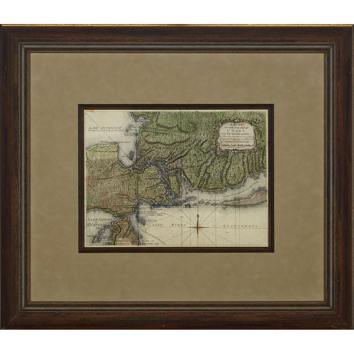
PLAN OF THE STRAITS OF ST. MARY, AND MICHILIMAKINAC, TO SHEW THE SITUATION & IMPORTANCE OF THE TWO WESTERNMOST SETTLEMENTS OF CANADA FOR THE FUR TRADE, 1761
Lot 515 Details
PLAN OF THE STRAITS OF ST. MARY, AND MICHILIMAKINAC, TO SHEW THE SITUATION & IMPORTANCE OF THE TWO WESTERNMOST SETTLEMENTS OF CANADA FOR THE FUR TRADE, 1761
early hand coloured engraved map of the Sault Ste. Marie area published by London Magazine, framed
sight 9.75" x 13" — 24.8 x 33 cm.; 21.5" x 24.75" — 54.6 x 62.9 cm.
Estimate $200-$300
Note:
Mackinac and Sault Ste. Marie each commanded a narrows in the Upper Lakes system, thus exercising great influence in the fur trade and becoming strategic sites for military activity. This highly detailed map depicts the mountainous and forested landscape and locates the Missions of St. Mary and St. Ignace. Includes interesting annotations concerning the Indian inhabitants: ‘Lake Superiour - Woship’d as a Divinity by the Indians’, ‘Channel of Manatouahlin, very little known’, and the ‘Common Track of the Vessels to the Detroit &c.’